An Exploration of Orbits and Their Vital Purposes
Look up at the night sky. What do you see? For most of human history, the answer was simply stars, planets, and if you were lucky, the ethereal glow of the Milky Way. Yet in the past 60 years, a new answer has made itself known – the steady march of satellites gliding silently overhead.
There are currently over 28,000 objects orbiting Earth, a number that grows larger every single year. But these satellites are not randomly strewn about in space. Rather, the dance of these human-made marvels is intricately choreographed, with satellites positioned in specific shells encircling our planet to optimize their functionality.
From enabling GPS navigation to powering internet connectivity, satellites in various orbital regimes grant us services that have revolutionized life in the 21st century. This article will guide you through four major orbital zones, from low Earth orbit to the Clarke belt, unpacking their distinguishing traits and showcasing their critical roles. Join me on a journey to discover the purpose behind the placement of satellites.
Low Earth Orbit
Imagine you are standing on the shoreline, waves lapping at your feet. Now picture wading further out – maybe knee-deep, waist-deep, finally all the way up to your shoulders. This gradual immersion mimics the concentric orbital layers surrounding Earth, the innermost of which is low Earth orbit (LEO).
What distinguishes LEO is its proximity to terra firma. Ranging from 160 km to about 2,000 km in altitude, it skims the top of our atmosphere and oversees the entirety of life below. The International Space Station (ISS), for example, zips around Earth in LEO just 400 km above the ground. What benefits does this prime terrestrial real estate provide? Superior visibility, faster communication, and lower launch costs compared to deeper space.
Thanks to its vantage point, LEO affords excellent high-resolution imagery and monitoring services. Remote sensing satellites in sun-synchronous orbits document environmental changes over time. Meanwhile, the aforementioned ISS doubles as an orbital laboratory, letting astronauts conduct experiments in microgravity.
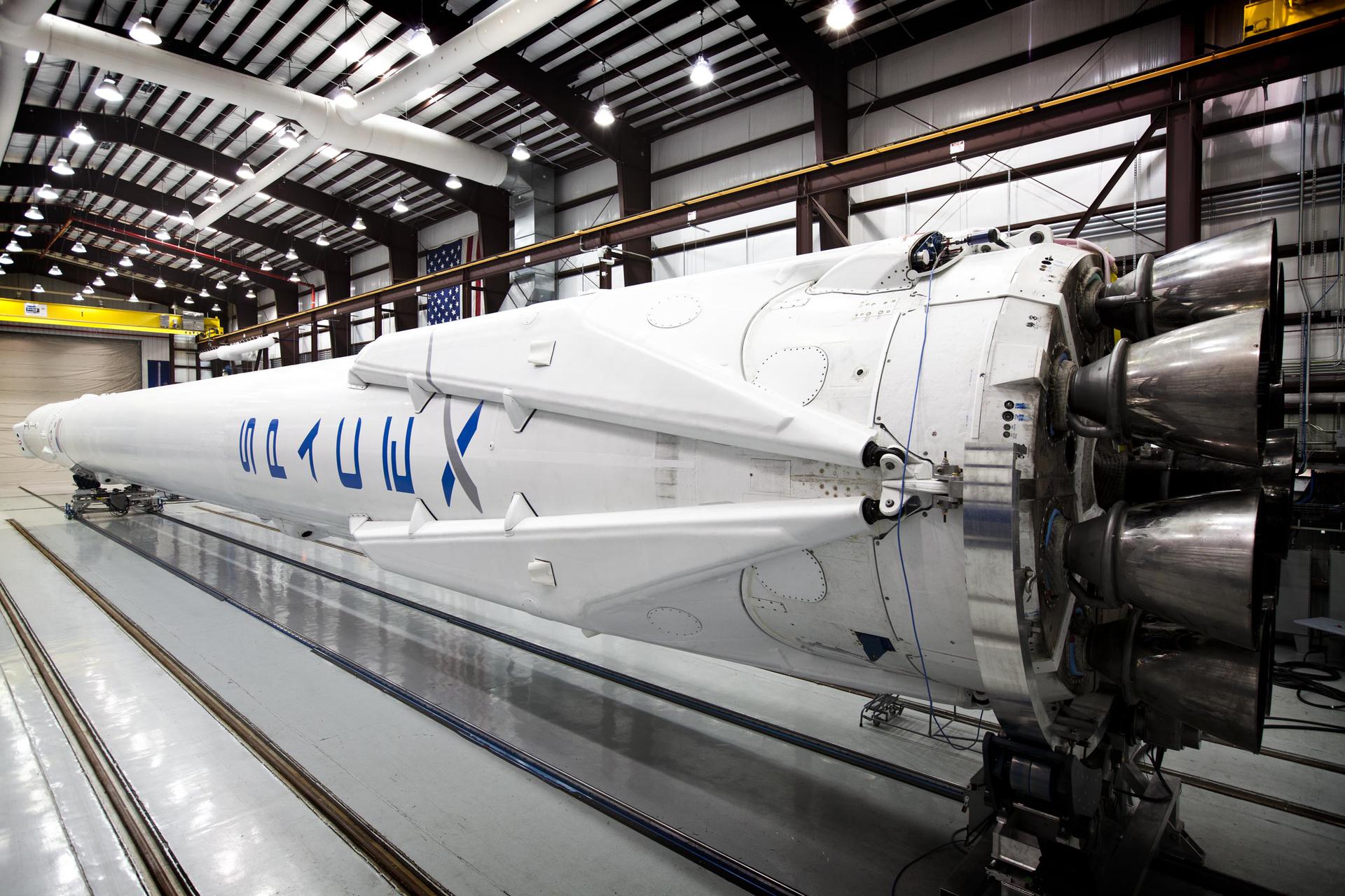
LEO’s combination of global reach and reduced signal lag also suits it well for satellite internet aspirations. Mega-constellations like SpaceX’s Starlink aim to provide low-cost broadband worldwide through vast networks of compact LEO internet satellites.
But Roscosmos, Russia’s state space agency, dealt these ambitions a blow in late 2022 when it conducted a controversial anti-satellite missile test to destroy a defunct Soviet-era satellite – the first known destruction of an orbiting satellite since 1985. This generated over 1,500 pieces of lethal debris that U.S. officials called ”reckless”, showing how escalating geopolitical tensions threaten sustainability even in LEO, our planet’s most hotly contested orbit.
Medium Earth Orbit
Traveling away from shore, the water rises above your head and the world muffles as you submerge. My analogy applies to the orbital regime with much less fanfare than its siblings – medium Earth orbit (MEO). Sandwiched between the well-studied LEO and GEO, MEO occupies an oft-overlooked middle ground starting around 2,000 km high.
Reconnaissance and scientific satellites occasional utilize this orbital middle child. But by far, MEO’s biggest claim to fame is as the home of navigation satellites like GPS, GLONASS, and Galileo. These constellations pinpoint locations and synchronize time for users worldwide, transmitting radio signals between roughly 3,000 to 8,000 km altitude.
So why MEO for navigation? Lower orbits don’t provide truly global coverage, while higher orbits induce more signal lag. MEO offers the best compromise, blanketing the planet so users virtually anywhere can pinpoint their coordinates within a meter.
Yet while GPS and company shine brightly, MEO itself remains dim and little studied compared to its crowded neighbors. This represents huge unrealized potential. We’ve barely scratched the surface of how robotics, materials science, astronomy, and more could benefit from MEO’s blend of coverage, communication speeds, launch efficiency, and microgravity conditions.
As SpaceX and others spur a mass migration to LEO, MEO serves as a reminder that breakout success hinges not just on orbit but innovators asking, “What can we achieve here that we couldn’t elsewhere?” Perhaps the accelerating commercial space race will soon reveal MEO’s hidden treasures.
Highly Elliptical Orbits
Our aquatic analogy falters here unless you’re a pearl diver plunge diving to the seafloor. Remote and enigmatic, highly elliptical orbits (HEOs) similarly represent mysterious uncharted territory compared to LEO and GEO’s relative familiarity.
What primarily defines HEO is its namesake eccentricity – an elongated, stretched-out orbit. Rather than tracing circles around Earth, satellites in HEO swoop far out into space before looping back in close proximity. This creates rollercoaster-like motion with drastic fluctuations in altitude over time.
For instance, while Molniya satellites ascend over 35,000 km high, they dive dramatically lower around 500 km near the North and South poles. This extreme elliptical trajectory allows spending more time loitering over high latitudes with optimal visibility.
Accordingly, Russia’s legacy Molniya system focused on communications and broadcasting over Siberia’s frozen expanses. Modernapplications also include missile early warning, signals intelligence (SIGINT), and detecting clandestine nuclear tests.
HEO’s variation in orbital speed proves useful too. Given matching directions, satellites in HEO can rendezvous with satellites in GEO using minimal fuel through intricate gravitational interactions – think cyclists drafting behind a semi-truck.
Military planners visualize leveraging this connectivity between HEO and GEO to cheaply dispatch surveillance, maintenance, or even attack satellites from one orbit to the other. While tensions between spacefaring nations continue escalating, such dual-use systems underscore the latent risks accompanying all orbital innovation.
Geosynchronous Earth Orbit
Our aquatic orientation concludes by rising into the air rather than delving deeper. Viewed from shore, geostationary satellites seem fixed in place, offering persistent coverage like a hovering lifeguard. Formally known as geosynchronous Earth orbit (GEO), this belt 35,786 km high facilitates everything from beaming TV signals and radio broadcasts to forecasting weather and spying strategically.
The key trait making GEO special is matching Earth’s rotation period. Satellites here orbit precisely once per day, continuously facing the same spot to provide reliable access. This feat would have astonished sci-fi author Arthur C. Clarke, who first described the possibility of such an orbit decades before human spaceflight.
Stationkeeping in this precarious gravitational sweet spot consumes constant tiny adjustments. But the payoff enables services like direct-to-home television that rely on a steady broadcast footprint. GEO also accommodates high-bandwidth communication relays supporting NASA deep space missions. When astronauts one day set foot on Mars, we may have GEO satellites to thank for transmitting their historic words and images back home.
Speaking of home, the National Oceanic and Atmospheric Administration (NOAA) utilizes GEO’s fixed field of view for continual weather observation across North America. GOES satellites monitor hurricanes and other severe storms, broadcasting early warnings that regularly save lives.
Finally, the United States Space Force operates satellites in GEOcapable of detecting missile launches worldwide. Tasked with deterring attacks on space systems, these sentinels exemplify how all Earth orbits have become congested theaters for geopolitical jockeying rather than peaceful exploration.
The Orbital Dance Continues
We’ve toured four major regimes-LEO, MEO, HEO, and GEO-that constitute Earth’s orbital infrastructure, underpinning services we increasingly depend upon in everyday life. Yet what does the future hold for both government and commercial operators as satellites proliferate?
All orbits face mounting challenges around congestion, debris, and conflict. LEO in particular nears a sustainability tipping point some experts compare to tragedy of the commons. And while private industry focuses on mega-constellations that promise immense profits, less prominent orbits remain comparatively unscrutinized despite their untapped potential.
Solutions surely involve international norms and policies shaping how humanity colonizes cislunar space. But equally vital is cultivating an ethical spacefaring consciousness that asks not just “What’s in it for me?” but rather “What’s best for all of us together?”
The intricate orbital dance of satellites will continue accelerating. As participants in this new space age, we shoulder collective responsibility for the shared global commons above Earth. Our crafts may someday enable wonders like beaming solar power down from space or mining asteroids. Yet we travel together on this spaceship called home. So just as crossing oceans relies on care, compassion, and cooperation between mariners, ensuring a hope-filled future in orbit depends first on mending relationships here on the ground.